Sunday, March 5, 2006

Sailing in the East of Siberia


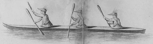
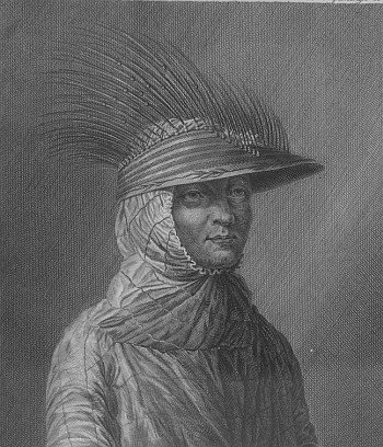
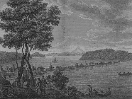
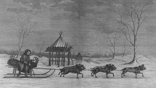
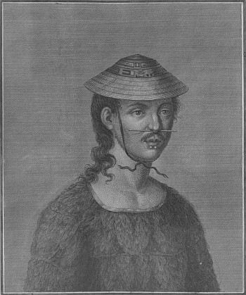
A product of the Russian Royal Navy, Gavriil Sarychev (1763-1831) joined a veteran of the Captain Cook voyages, Joseph Billings, in an 8 year geographical and ethnological expedition to the coasts of Siberia and Alaska and the Aleutian Islands.

Their trip was supported by Catherine the Great who instructed them "to bring to perfection the knowledge acquired under her glorious reign." Her instructions, issued through the Russian Academy of Sciences, also asked that they detail ' "all the remarkable places" and "the natural curiosities" they encountered both on land and at sea. They were also to interview, observe, and describe all the peoples they met.'

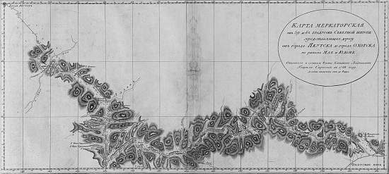
Although the mission was something of a financial disappointment, there was an emphasis placed on gaining cooperation of native groups in all facets of their investigations. Consequently for instance, the maps (still considered to be of high quality) included local names, many of which persist. Sarychev went on to become an Admiral, an Honorary member of the Science Academy, Hygrographer-General and ultimately head of the Naval Ministry.

Saturday, March 4, 2006

Lily


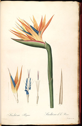
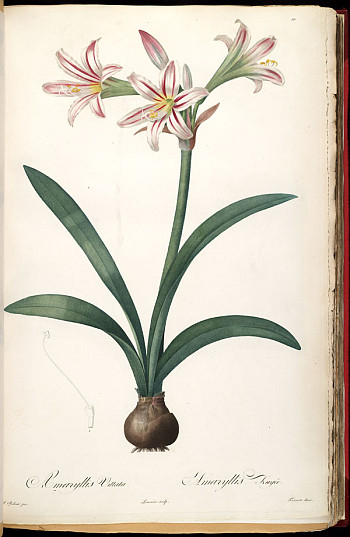
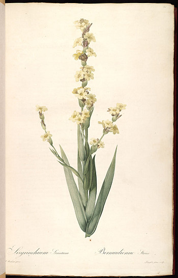
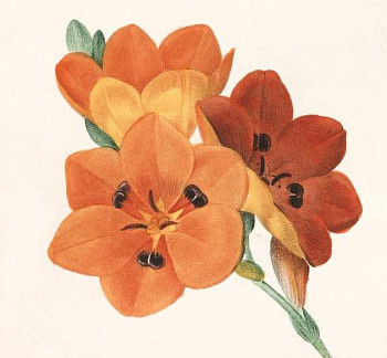
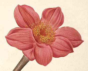
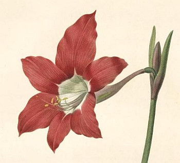
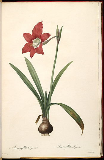
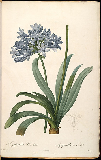
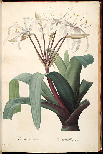
Belgian born Pierre-Joseph Redouté (1759-1840) held a uniquely favoured status in France before and after the Revolution. Queen Marie Antoinette and Josephine were both enthusiastic patrons of his renowned floral artistry.

He began his career as an itinerant church decorator at the age of 13 but eventually joined his brother in Paris as a theatre painter. While in Paris, Redouté had time to pursue his interest in flower illustrating and he was introduced to the botanist Charles L’Héritier who helped to guide his career, emphasizing a balance between science and art. L’Héritier took him to England and published his first prints.

The 3 works for which Redouté is best remembered are Les Liliacées (1802-1815), Les Roses (1817-1824) and Choix des Plus Belles Fleurs (1827-1833). He introduced the technique of stipple engraving (where dots rather than lines were applied to the copper plates) to France which conferred a softness onto the intricate detail of his illustrations and brought him international success and wealth.

I spent quite some time examining Volume I and removing images and then realized that Les Liliacées is actually composed of 8 volumes. So all of the above come from the first 2 volumes.
There's some personal irony here in the fact that I was almost certain that I'd posted something about Redouté previously but nothing turned up on searching. The reason it felt familiar is that I've actually gone through many of the background sources previously but just hadn't got my act together to make a post.

I have been thinking lately anyway of going through all the posts here and adding them to del.icio.us because I really am forgetting what I've read/seen versus what I've posted. I'm still not convinced it will be of use either to myself or to other people - does anyone have any opinion on this? Stingy Scholar did it recently.

I have a 'personal' delicious account (which is not difficult to identify) but I find myself hardly ever actually using the tags to find links. I either just scan the pages or use 1 or 2 tags to find things. This whole social bookmarking fad is great for finding things from other people I guess, but it doesn't actually organize me more efficiently.

The Illustrated Garden are using delicious to organize their huge digital collection
- that's the ironic part, by the way. They want volunteers for tagging if anyone is interested.

Friday, March 3, 2006

La Science Amusante


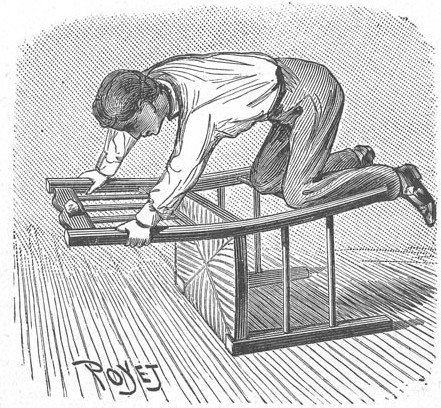
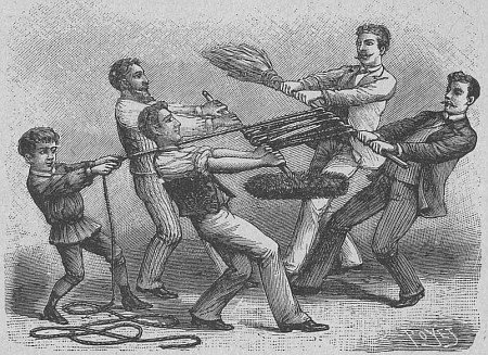
La Science Amusante - 100 Nouvelles Experiences by Tom Tit (Arthur Good) with illustrations by Poyet was first published in the french magazine L'Illustration and later released in 3 sections between 1890 and 1893.

It was obviously aimed at youngsters, outlining how they could go about astounding their friends with feats involving static electricity, shadow effects, water tension, vacuums, balancing and other simple scientific phenomena.

La Science Amusante is online at the FullTable website, which has a slow server.
Thursday, March 2, 2006

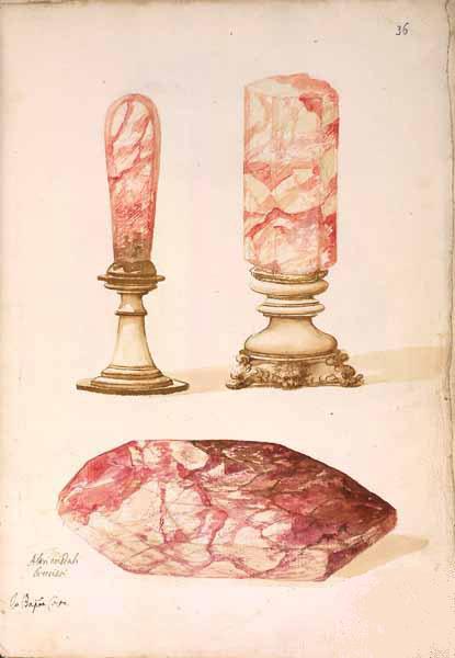
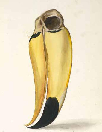
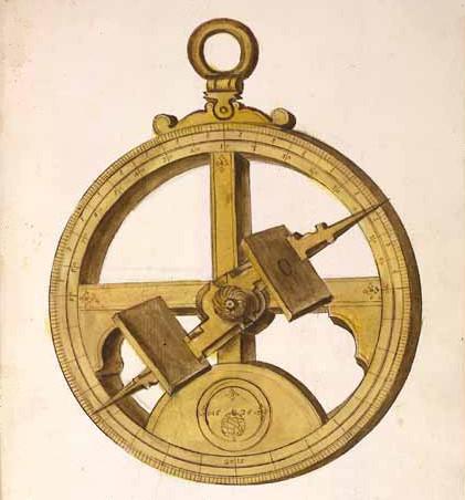
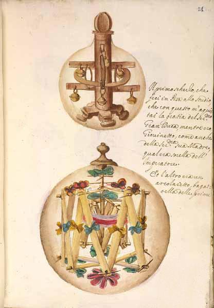
Settala's Wunderkammer

"...a goodly, huge cabinet, wherein whatsoever the hand of man by exquisite art or engine has made rare in stuff, form or motion; whatsoever singularity, chance, and the shuffle of things hath produced; whatsoever Nature has wrought in things that want life and may be kept; shall be sorted and included." [Bacon]


[click the images for full size versions]

It's little wonder that the drama and embellishment of the baroque aesthetic gave rise to a 17th century enthusiasm for the wunderkammer or 'cabinets of curiosity' that would eventually beget our modern museums. I was a little surprised in reading around at just how popular they were across Europe. Increased world travel and trade brought a variety of oddities back to the monied elite who would display them in order to demonstrate a deeper understanding of their changing world.

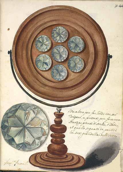
One such famous collector was Manfredo Settala (1600-1680) of Milan who Filippo Picinelli described as "the Archimedes of our century". Settala was from a noble family and had an opportunity to travel abroad early in life when his fascination for collecting all manner of unusual naturalistic, ethnological and artistic specimens began. He was also interested in science and became proficient in metalwork and the instruments he crafted on a lathe were added to his collection; which also included a huge library.

During the 1660s a catalogue of his 3000-odd specimens was commissioned and artistic contributions to the inventory were made by Domenico Tencala, Francisco Porro, Giovanni Battista, Francisco Volpino, Alfonso Coast, Carolo a Sole and Carolo Galluzio. The images here are from the 3rd volume (the first 2 are housed in the library at Modena) and depict vases, clocks, animals, skulls, jewellery, crockery, precious stones and crystals and the instruments made by Settala himself. Some of these latter objects were modified with for instance magnets (eg. the fish in the image above would spin) so as to increase their novelty value.

I've only skimmed the wide selection of online sources and hope I've understood the translations correctly - as always, buyer beware. I've retouched most of the above images to try to remove the watermarks.

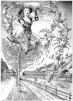
José Roosevelt


Illustrations © José Roosevelt

Wednesday, March 1, 2006

Middle Earth

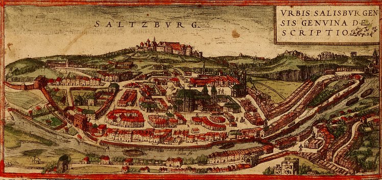
Saltzburg, Austria

Vilnius, Lithuania

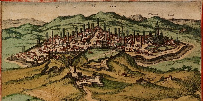
Siena, Italy

Vienna, Austria

Moscow

Barcelona

Algiers, Algeria

Marseille

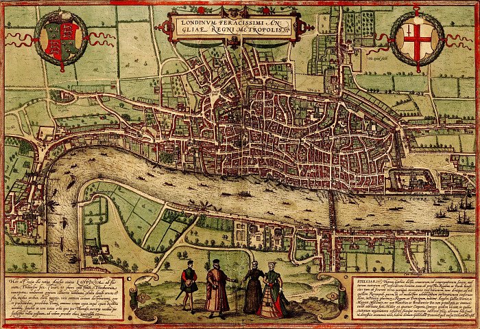
London


"The view of Venice is that of 1565 by Bolognino Zaltieri (fl. 1560-80))—a feast for the eyes reflecting the wealth and architectural richness of the Serenissima. It references 188 buildings, bridges, and areas of the city by number, and it individually identifies many more of the canals, churches, and surrounding islands. Few have changed today. The image is a celebration of the city's political power as much as a spatial guide to its monuments and form. The wide variety of ships in the image underscores Venice's naval and economic dominance in the Adriatic. The political identity of the city is emphasized by the inclusion of a ceremonial procession of the Doge and members of the patriciate Senate of the city, here shown in formal dress, depicted in the center insert in the image's lower panel."
[Click the pictures for larger versions]

Civitates Orbis Terrarum ('Cities of the Earth') is a mammoth 5 volume publication of over 540 city maps (mainly in Europe), released to great popularity between 1572 and 1617. The principal editor was Georg Braun and among the 100 people involved in its production, Belgian Frans Hogenberg did most of the engraving work.

Jovis Hoefnagel (and later his son Jacob) provided the bulk of the birds-eye city drawings but there were many sources used. Abraham Ortelius, who produced the first world atlas, was both an inspiration and practical advisor for the Civitates Orbis Terrarum project. Indeed, Hogenburg had engraved most of the plates in Ortelius's groundbreaking 1570 Theatrum Orbis Terrarum.

Interestingly, Braun mentions in Volume 1 that the human figures seen in many of the maps were added not so much as a popularizing embellishment, but as a precaution to prevent the Turks from acquiring military secrets. Their religion forbade them from gazing on depictions of people...or so the story goes.

The maps in fact invite quite a depth of historical scholarship - there is a geospatial accuracy in relation to much of the architecture and city planning, fortifications as they actually existed are included, the costumes of the people are themselves source material and an overall sense of the economic and trade status of these urban centres can be inferred.
There are quite a few sites around with some commentary, none of which particularly struck me as authorities. I would head to a real book methinks. Maybe I'm just lazy with my searches or I'm particularly skeptical today. [I originally found the Historic Cities site via the consistently exceptional and prolific plep].


On a completely different note, if you haven't come across the Coudal Partners website before, go check it out, including their MoOM. Despite my making guest contributions there this month, it's a great site.


UPDATE 2010: (essentially seems to be the same as above as far as I've looked) -- Braun, Georg; Hogenberg, Franz; Novellanus, Simon Beschreibung vnd Contrafactur der vornembster Stät der Welt (Band 1) at the University of Heidelberg.