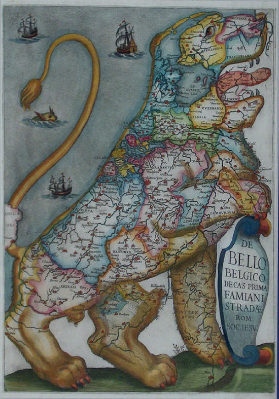
In the annals of medieval/renaissance cartography, the curious fashion of depicting the seventeen provinces of the (then) Low Countries as being part of a lion began in c. 1583. The Austrian Baron, Michael Eitzinger (or Aitzinger or van Aitzing), settled in Cologne after travelling Europe for thirty years and published his History of the Low Countries in his role as historian and cartographer to Emperors Ferdinand II and Maximillian II.
The suggestion for his Leo Belgicus probably derives from almost all of the provinces having a lion in its coat of arms. The initial map proved to be popular and various copies and derivations were published over the next couple of centuries. There were four major variants produced that took into account the permanence of the coastline feature, the changes in political status and the eventual independence gained by Holland. The above map comes from the Jesuit engraver and author Famiani Strada, whose Histoire de la Guerre de Flandres version was released in 1631.
No comments:
Post a Comment